DJI FlightHub 2 Updates Enhances Drone Mapping and Inspections with New Features for DJI Dock 2
Unlock the full potential of drone mapping and inspections with DJI FlightHub 2's innovative features.
New FH2 Updates: Explore the latest features, including Geometric Routes for automated inspections, Slope Routes for enhanced data collection in uneven terrain, and AR Projections for improved flight visualisation and accuracy.
Advanced Flight Controls: Discover updates to Live Flight Controls, including Discreet Mode, manual camera settings, and support for dewarp and mechanical shutter on DJI Matrice 3D.
Enhanced Video Capabilities: Learn about new post-production options, such as embedding subtitles and visual commentary in your recorded footage.
DJI has announced a series of new features and updates to DJI FlightHub 2 (FH2) that will make DJI Dock 2 operations more efficient and streamlined when operating with the DJI M3D mapping drone.
FH2 is a cloud-based software designed for remote and automated operations with the DJI Dock 2. It streamlines coordination between ground teams, drones, and pilots, offering advanced tools for mission planning, data management, and real-time communication; making it ideal for public safety, industrial inspections, and other remote operations.
DJI's updates will further enhance coordination between ground teams and pilots, improve situational awareness, and offer advanced tools for mission planning, data management, and real-time collaboration, which will be particularly effective for public safety, industrial inspections.
New Features Include:
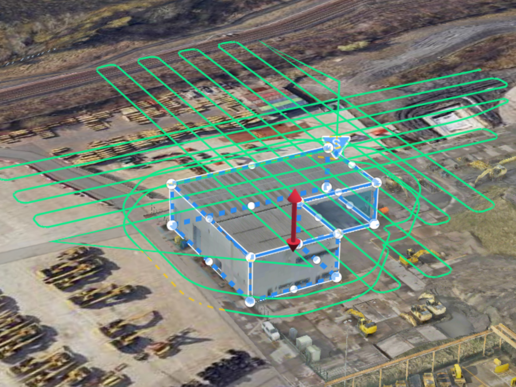
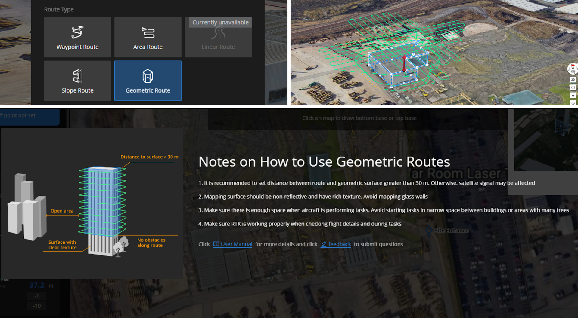
Geometric Routes: DJI Dock 2 now supports geometric routes, enabling FH2 users to draw boundaries on a map and generate routes for comprehensive inspections of land plots, buildings, and construction sites.
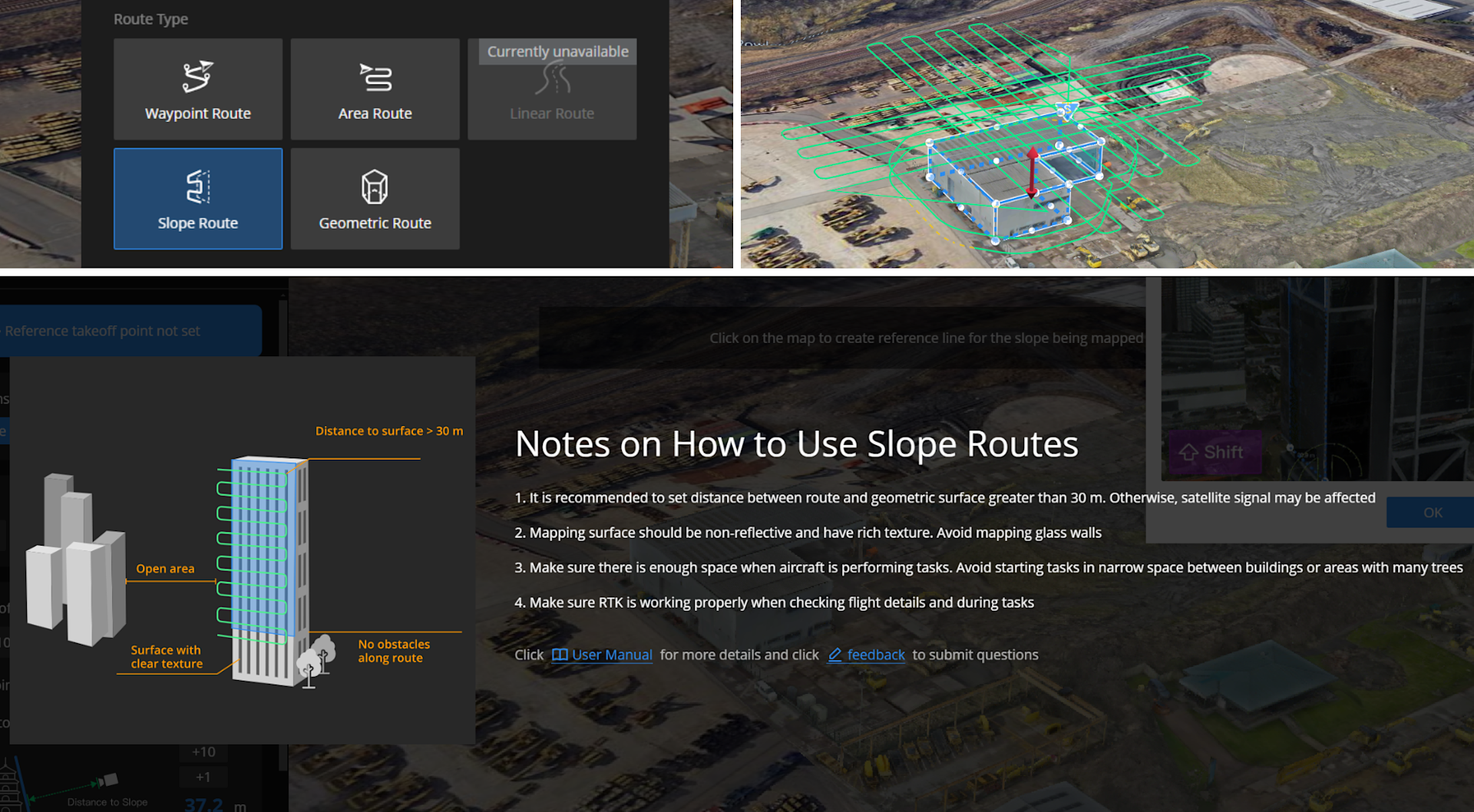
Slope Routes: This feature is perfect for inspecting unique building structures and landscapes, as it enables accurate data collection in sloped areas that typical settings might not plot as precisely.
AR Projections: The new AR Projection enhances flight visualisation by displaying live feeds and maps with projected points side-by-side; allowing operators to better understand the drone's position relative to plot points, and improves geographical awareness and accuracy.
With the recent FlightHub 2 update, Slope and Geometric routes will further streamline operational efficiencies, allowing pilots to not only automate existing manual workflows but increase the accuracy of collected data. Through the simplicity of Flight Hub 2 mission planning when integrated into the DJI Dock ecosystem, operators can focus their effects on specific areas of interest whilst increasing frequency and repeatability of data collection for long-term asset management.
Brandon Jones, Training Instructor at heliguy™.
In addition to these new features, FH2 has also updated its Live Flight Control features to improve functionality and user experience. You can now enable Discreet Mode (no lights on), adjust manual settings for shutter speed, ISO, and aperture, and use dewarp and mechanical shutter settings for the DJI Matrice 3D.
More updates include supporting panoramas in Waypoint routes for DJI Dock 2. Users can transfer PPK files from DJI Matrice 3D to the cloud, download them, and access them via FlightHub Sync or Cloud API. Additionally, videos captured by DJI Dock 2 can now include embedded SRT files, which can be downloaded and accessed through FlightHub Sync or Cloud API.
Geometric Routes
The Geometric Route feature creates routes based on boundry lines you set on the flight map; streamling manual workflows by automating missions that would otherwise require extensive manual flying. By drawing boundaries on the map, FH2 generates the optimal flight path to capture comprehensive data from multiple angles. This feature is particularly useful for inspections aimed at capturing an overall view of entire buildings rather than focusing on specific areas.

Slope Routes
Slope Routes are ideal for facade inspections and uniquely shaped buildings or landscapes with slopes and irregularities. When setting boundary lines, you can adjust for slopes, enhancing data collection accuracy in hilly areas. This feature is particularly well-suited for missions focused on specific elements, such as coastal defence operations, as it provides more precise data by accounting for land contours and dips compared to traditional methods.

AR Projections
AR Projections in the Flight Deck allow you to view telemetry alongside the camera feed and map with the PinPoints you set. This side-by-side display enhances visual understanding, geographic accuracy, and tracking by showing your current position relative to your intended locations. Previously unavailable on DJI Dock 2, it is now accessible, offering versatility for missions of any length, including surveying and inspections.
Overview
Overall, the latest DJI FlightHub 2 updates enhance drone operations with features like Geometric Routes, Slope Routes, and AR Projections for better accuracy and efficiency. Improved Live Flight Controls and new post-production options further boost functionality.
As a certified DJI Dock 2 Partner, Heliguy™ offers expert consulting on FlightHub 2. Our team specialises in integrating FlightHub 2 into operations to enhance efficiency for public safety, industry inspections, and surveying missions.
Contact us to discuss FlightHub 2 and to integrate it into your drone enterprise, contact heliguy™.