Drone Surveying Course
The heliguy™ Aerial Surveying Training Course provides end-to-end workflow support to help professionals fully utilise drones for surveying. It focuses on the fundamentals and principles of drone mapping, with a focus on DJI solutions.
Learning Outcomes This modular course covers flight planning, data capture, data processing, and data deliverables - for photogrammetry and LiDAR.
Course Delivery Delivered by our in-house survey specialists over a period of up to five days, the course comprises theory, practical, and scenario training, delivered in the classroom and the field.
heliguy™: Your Drone Training Partner Learn from our dedicated surveying specialists, who have delivered training to the likes of Phillips 66, Associated British Ports, and Balfour Beatty VINCI.
- Overview
- Specifications
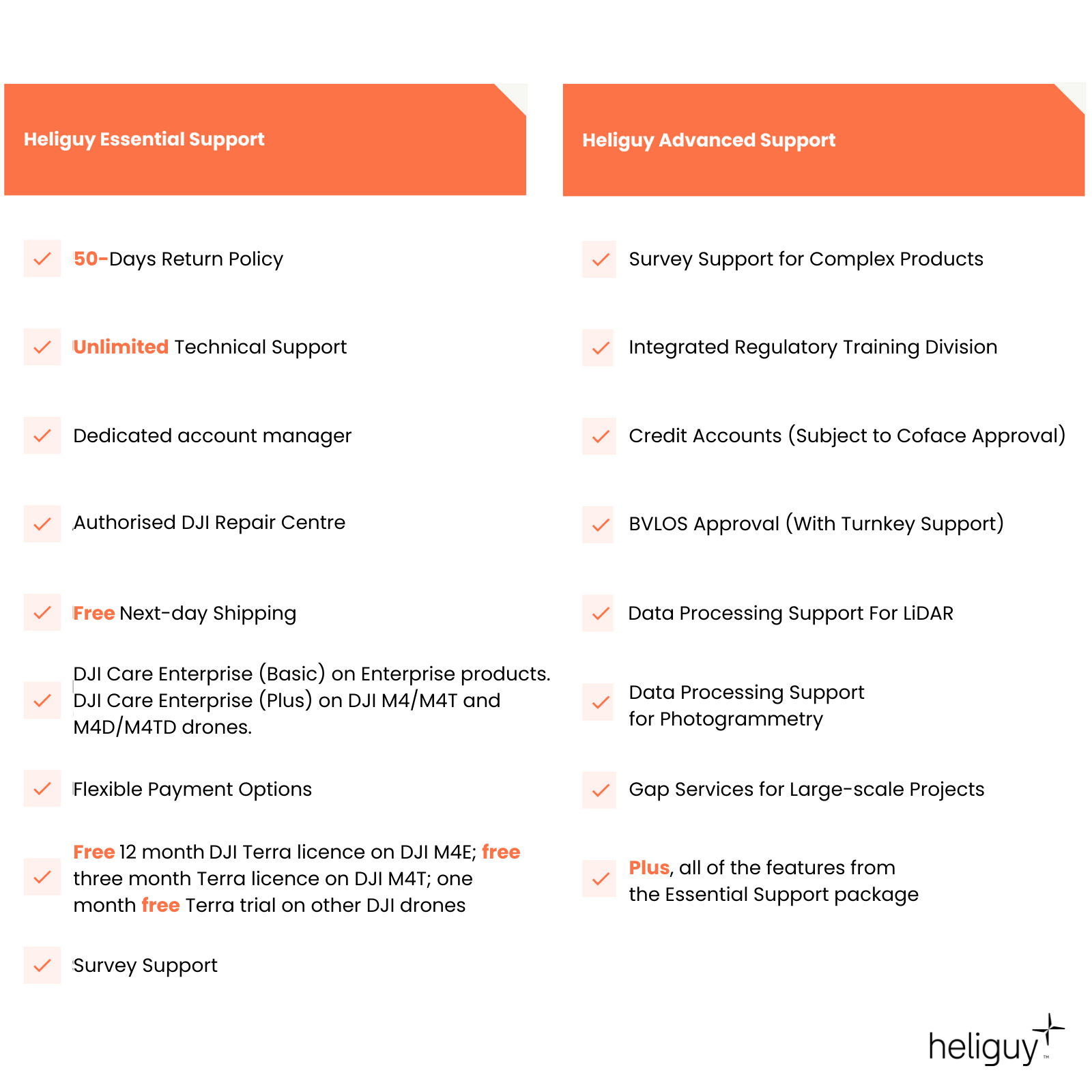
- Support
- FAQ
- Heliguy Services
Aerial Surveying Training Course: Learning Outcomes
Unleash the full potential of your drone surveying workflows
The heliguy™ drone surveying course provides attendees with a comprehensive understanding of using a drone for surveying.
The course covers:
Mission planning
Data capture best practises and workflows, including oblique, topographic, and manual drone flights
GNSS data collection: Understanding NTRIP, base stations, and rovers
Ground control and check points
Photogrammetry and LiDAR drone mapping
Processing software, including DJI Terra and TerraSolid
Data processing, cleaning, and analysis, including volume calculations
Data outputs/deliverables, such as 2D orthomosaics and 3D modelling

How Is The Course Delivered?
Exclusive learning environment
The course It is delivered in a closed-course format, offering each organisation the chance to learn in an environment that is exclusive to them.
It is aimed at enterprise organisations that have recently adopted drones for surveying and want to benefit from expert support to help them realise the full potential of unmanned aircraft for drone surveying.

heliguy™: Your Drone Survey Partner
Supercharge your drone surveys with heliguy™ by your side
heliguy™ has a dedicated drone and land surveying department offering end-to-end workflow supply and support. Benefits of choosing heliguy™ include:
Consultancy and product supply.
On-site real-world data collection and scenario-based training.
Technology handovers.
Vast product ecosystem, including drones, LiDAR sensors, photogrammetry cameras, handheld scanners, GNSS equipment, and software packages.
Department expertise includes Geographical Information Science, Land Surveying and Mapping Science, and Civil and Structural Engineering.
The in-house team comprises graduates from Newcastle University's prestigious geospatial school.
Learn from a team that supports clients such as Komatsu and Laing O’Rourke, and has delivered survey-specific training to the likes of Phillips 66, Associated British Ports, and Balfour Beatty VINCI.
The team developed and presented an online DJI L1 LiDAR course - subsequently purchased by DJI Enterprise for roll-out to its global surveying community.
Lifetime assistance, including data processing advice, crash support, and repairs.

Accreditation
![UK CAA Recognised Assessment Entity (RAE)]()
UK CAA Recognised Assessment Entity (RAE)
Authorised GVC/A2 CofC Training Courses
![UK CAA Permission for BVLOS Flights: Operational Authorisation UAS 15435]()
UK CAA Permission for BVLOS Flights: Operational Authorisation UAS 15435
Helping companies unlock BVLOS missions in an AAE with DJI Docks
![The UK's only DJI Gold and S-Level Partner]()
The UK's only DJI Gold and S-Level Partner
Trusted supply on DJI products
![ISO 9001 Certification]()
ISO 9001 Certification
Driving industry standards through robust operational protocols for enhanced safety and reliability
![Training Qualifications UK]()
Training Qualifications UK
Accredited training courses endorsed by TQUK.
![Ofqual-regulated Training]()
Ofqual-regulated Training
Recognised quality mark for meeting accreditation criteria.
![Cyber Essentials]()
Cyber Essentials
Verified data security
![Financial Conduct Authority]()
Financial Conduct Authority
Authorised to conduct regulated financial services
![Armed Forces Covenant Defence Employer Recognition Scheme - Silver Award]()
Armed Forces Covenant Defence Employer Recognition Scheme - Silver Award
Proud supporter of our Armed Forces
![D-U-N-S Registered: 77-916-1210]()
D-U-N-S Registered: 77-916-1210
Verified to conduct international business


