Drone Surveying Software
Transform drone data into actionable insights
Digitise Your Data
Explore our suite of leading drone survey software for UAS mapping data
Advanced Analytics
Generate datasets for enhanced visualisation, advanced flight planning, and accurate measurements.
Intelligent Software Suite
Browse our surveying software ecosystem for photogrammetry, LiDAR, and multispectral data.
Data-processing Support
heliguy™ surveying team can help you pick the best solution and offer in-house processing support.
Drone Survey Software
Enhanced visualisation for optimised project management
Software is a crucial part of the surveying workflow - transforming collected data into detailed and precise maps and models.
Use these digital assets to better understand what is happening on your site, monitor progress, conduct precision measurements, spot issues early, and for advanced flight planning.
Share these datasets teamwide for enhanced collaboration and optimised project management, oversight, and planning.
heliguy™ offers a range of industry-leading software solutions for photogrammetry, LiDAR, and multispectral data, and our in-house geospatial specialists can help you choose the optimal package for your needs.
Our geospatial specialists also offer in-house data-processing to assist with your surveying workflows.
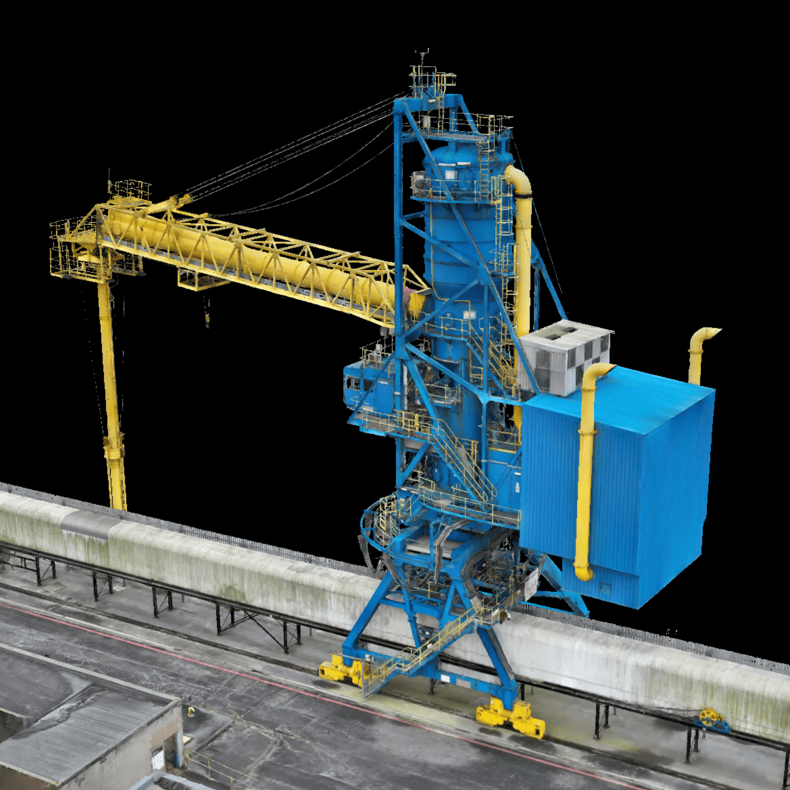
DJI Terra
Process photogrammetry, LiDAR, and multispectral data
DJI Terra enables efficient and accurate processing of photogrammetry, LiDAR, and multispectral data collected with DJI drones and payloads.
DJI Terra Key Features:
Photogrammetry Datasets: Create realistic 3D models and precise orthophotos and DSMs.
LiDAR Point Clouds: Generate 3D point clouds, conduct ground point classification, and output DEMs and contours.
Multispectral Maps: Produce vegetation index maps and create prescription maps for variable rate applications using DJI Agras drones.
Application Integration: Supports outputs in common formats, including TIFF, LAS, OSGB, and OBJ. Integrate into GIS, CAD, and other third-party software.
Elevated Accuracy: Built-in 8500+ result coordinate systems support local coordinate systems and seven-parameter transformations. Support for control points enables automatic point marking/correction in photogrammetry and point cloud reconstruction.
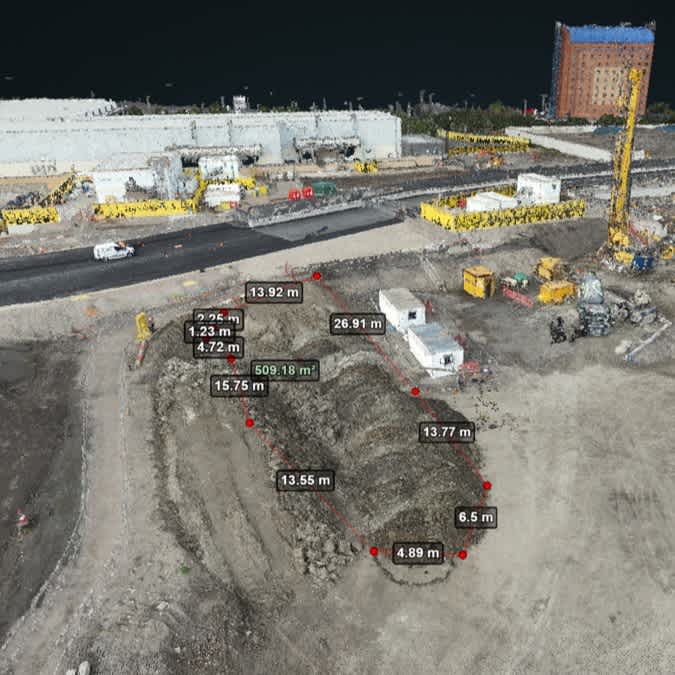
Streamlined Analysis: Analysis tools, volumetric calculations, and 2D/3D model planning.
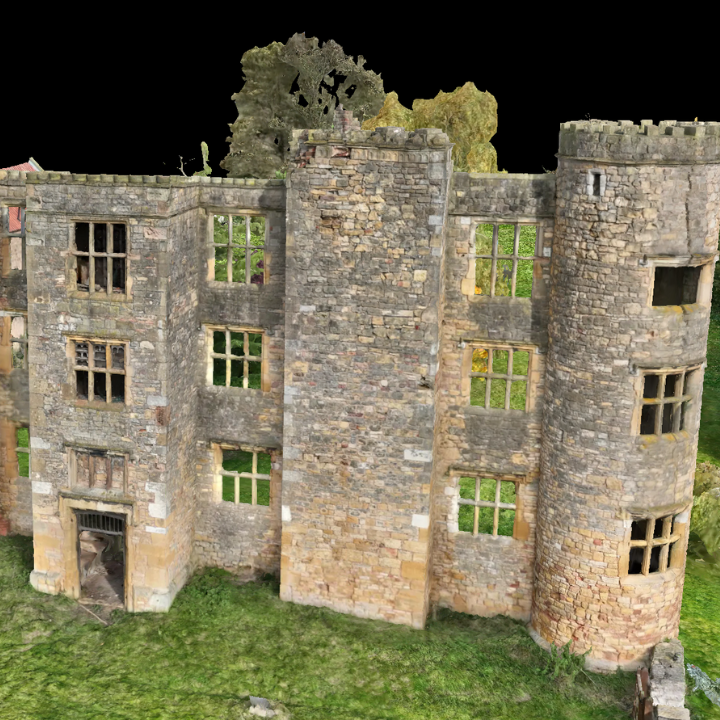
DJI Modify
3D model editing software
DJI Modify is DJI’s first intelligent 3D model editing software. Paired with a DJI Enterprise drone and DJI Terra, it forms a comprehensive solution from aerial surveying through to modelling and model editing.
DJI Modify Key Features
Efficient 3D Model Repair: Remove floating parts, flatten vehicles, repair textures, fill holes, and repair water surfaces.
Seamless Workflow: With one click, DJI Terra can launch DJI Modify for an end-to-end solution from modelling to model editing.
Cloud Sharing: Export in formats such as ply, obj, and b3dm, and share processed models to the cloud for team members to view.
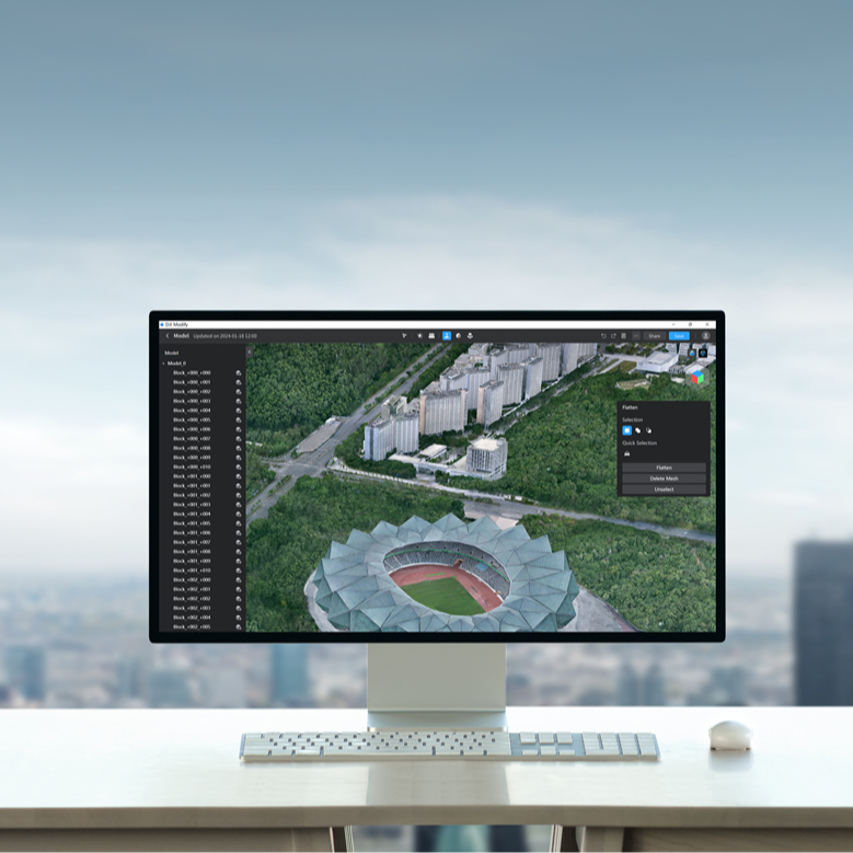
DJI FlightHub 2
Cloud-based software for automated drone surveying
DJI FlightHub 2 is an all-in-one cloud management software designed to facilitate automated and remote drone photogrammetry surveying with the DJI Dock 2 drone in a box. DJI FlightHub 2 Key Features:
Cloud Mapping: Upon mission completion, DJI FlightHub 2 automatically generates high-precision 3D models based on collected flight data. These models can be annotated, measured, and downloaded.
Flight Route Editor: Use 3D models to remotely plan and edit flight routes and simulate imaging results.
Live Flight Controls: Take control of the flight and gimbal via keyboard and mouse during remote operations.
DJI TerraAPI: Integrate the mapping capabilities of DJI Terra into your dock management systems for automated 2D/3D reconstructions and customised photo mapping workflows.
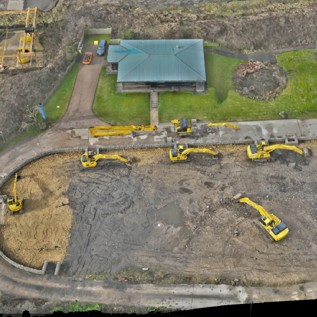
Site Scan for ArcGIS
End-to-end cloud-based drone mapping software
Site Scan for ArcGIS, part of the ArcGIS Reality suite of products, is an end-to-end, cloud-based drone mapping software for drone photogrammetry data collection, processing, and analysis.
Site Scan Key Features:
Fleet Management: Keep tabs on drone operations with automatic fleet management. Create and use repeatable flight plans - including 3D plans - to ensure repeatable and high-quality data capture.
Cloud Environment: Securely process imagery in a scalable cloud environment to create high-quality 2D and 3D photogrammetry assets that can be shared throughout your organisation, on any device.
Analytics: Use measurement and analysis tools to obtain actionable insights from your data. Drone data can be published to the ArcGIS ecosystem for advanced analytics, such as object detection and AI application, via ArcGIS Image Analyst.
Terrasolid
Point cloud intelligence
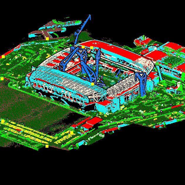
Terrasolid is a leading software for point clouds and image processing, developed for the demanding requirements of geospatial, engineering, and environmental professionals.
Terrasolid Key Features:
Capable Tools: Create 3D vector models, feature extractions, orthophotos, terrain representations, and advanced point cloud visualisations.
Versatile: Supports handheld scanners, or choose a package dedicated to drone mapping, including LiDAR surveying with the DJI Zenmuse L2 and L1.
Companion Tool: Terrasolid can be used as a complementary software to DJI Terra, facilitating further point cloud manipulation, cleaning, and classifying.
XGRIDS: Lixel Studio and Lixel CyberColour
Advanced software suite for next-gen 3D content creation
LixelStudio and Lixel CyberColour are intelligent software solutions from XGRIDS, designed for 3D processing and photorealistic model creation.
LixelStudio: Companion software for the XGRIDS Lixel L2 and K1 handheld laser scanners. Provides viewing, editing, data vectorisation, and one-stop processing services for laser point clouds and other data, along with industry plugins.
Lixel CyberColour: Based on multi-SLAM algorithms and 3DGS technology, Lixel CyberColour uses Gaussian Splatting to enable the creation of true-to-life, vast 3D models and digital twins. Benefit from AI-powered object removal, VR interaction, and integration with professional 3D software and platforms.

Emlid Flow And Emlid Studio
Create and manage survey projects
Deploy Emlid's geospatial software for data collection and post-processing. It works in conjunction with Emlid's GNSS receivers.
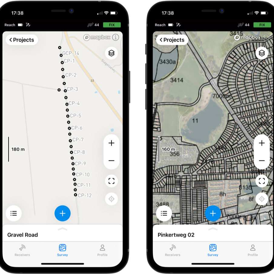
Emlid Flow: This companion app for Emlid Reach receivers supports thousands of coordinate systems. Perform survey activities such as data collection, coding, linework, and staking.
Emlid Flow 360: Web-based application for creating and managing survey projects. Works with the Emlid Flow mobile app for syncing between the office and the field, and enables you to prepare, export, and manage survey data from any web browser.
Emlid Studio: Post-processing land survey software. It works with RINEX and UBX logs from GNSS receivers and RTK drones.
Premium Positioning
Network RTK subscription service
Premium Positioning is an industry-leading and cost-effective GNSS correction service enabling you to rapidly reach centimetre (1cm) accuracy on your GNSS device.
Premium Positioning Key Features:
Vast Compatibility: Premium Positioning is compatible with every GNSS device and is globally present with more than 2,000 base stations.
High Accuracy: Accuracy of <1.5cm with European certification.
Large Baseline Distance: Obtain EU-certified ETRF coordinates. Premium Positioning enables an average baseline distance of 70 km.
M2M Sim Not Required: Network RTK subscription is available without an M2M SIM.

Supported by industry leading solutions
Our equipment, expertise, and support will ensure success for your undertaking
Frequently Asked Questions
Why should I choose heliguy™ to help my organisation adopt and utilise drone survey software?

What types of drone survey software does heliguy™ offer?

How can heliguy™ assist with the integration of drone survey software into your existing systems?

Does heliguy™ provide training for using drone survey software?

Can heliguy™ help us choose the right drone and software combination for our survey needs?

What kind of ongoing support does heliguy™ provide for drone survey software?

What is drone surveying software?

Is drone surveying software suitable for my industry?


