Drone LiDAR
Accurate and precise point cloud generation
What Is Drone LiDAR?
Drone LiDAR is a remote sensing technology that uses rapid laser pulses to measure distances to objects or surfaces, creating precise 3D maps or models of the terrain or objects below.
Pairing a LiDAR scanner with a drone makes LiDAR more accessible, and allows surveyors and other professionals to collect precise data, quickly, efficiently, and safely over large areas.
Drone LiDAR finds applications in various fields such as agriculture, forestry, urban planning, construction, archaeology, and environmental monitoring.
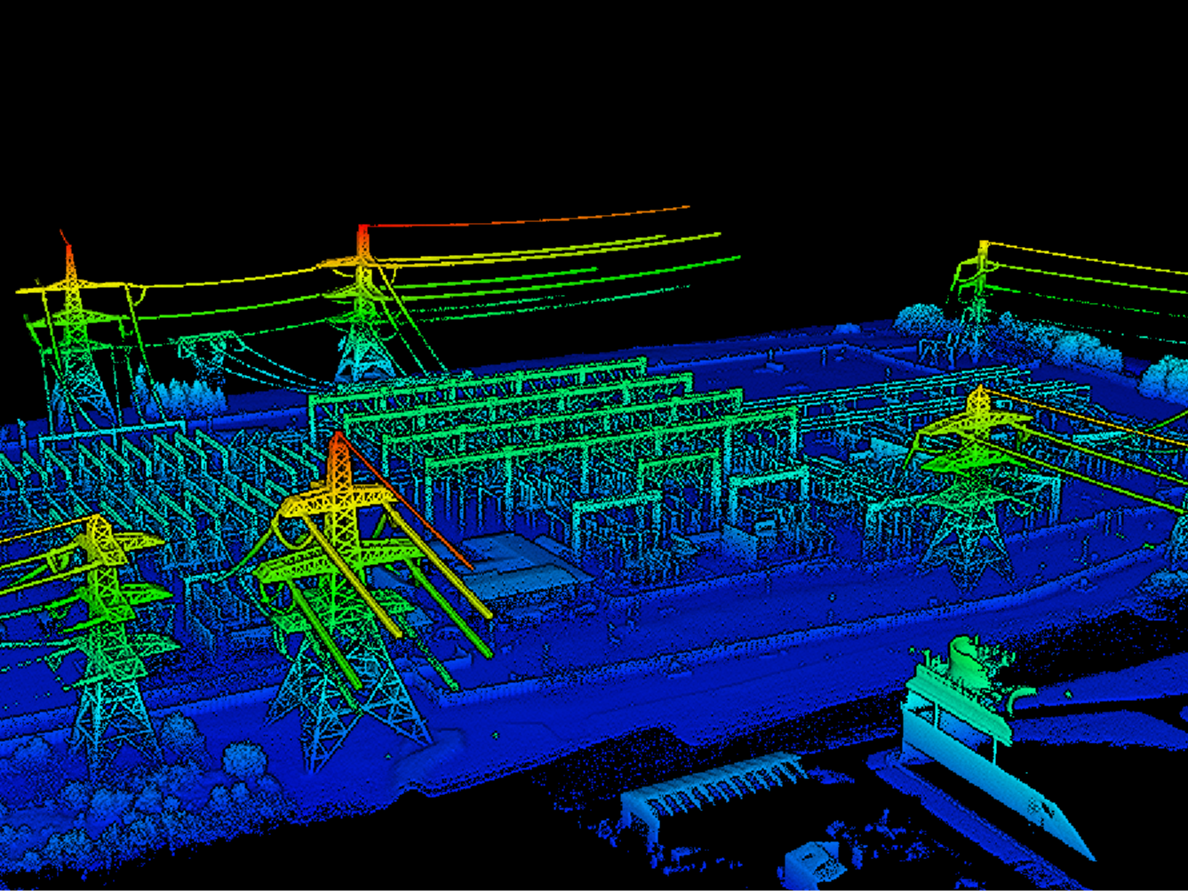
Benefits Of Drone LiDAR
High Precision and Accuracy: Obtain accurate measurements of distances and elevations, resulting in precise 3D models: Crucial for topographic mapping, infrastructure inspection, and construction site monitoring.
Vegetation Penetration: LiDAR performs well in densely-vegetated areas, capturing the ground surface below the canopy. This is valuable for forestry management, where accurate terrain models are needed despite heavy tree cover.
Small Object Detection: Detect and capture small objects with enhanced clarity: Important for infrastructure inspection, urban planning, and archeology.
Rapid Data Collection: Cover large areas quickly and efficiently, reducing the time and cost associated with traditional ground-based surveys or manned aircraft flights.
Versatile Operations: Deploy LiDAR in low-light conditions, at night, or in foggy or rainy conditions.
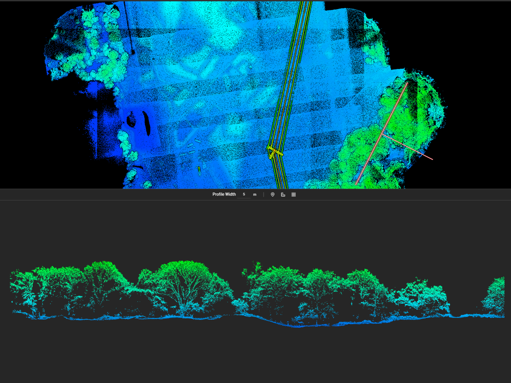
Drone LiDAR Outputs
Point Clouds: Collection of 3D coordinate points representing the surfaces of objects or terrain captured by the LiDAR sensor.
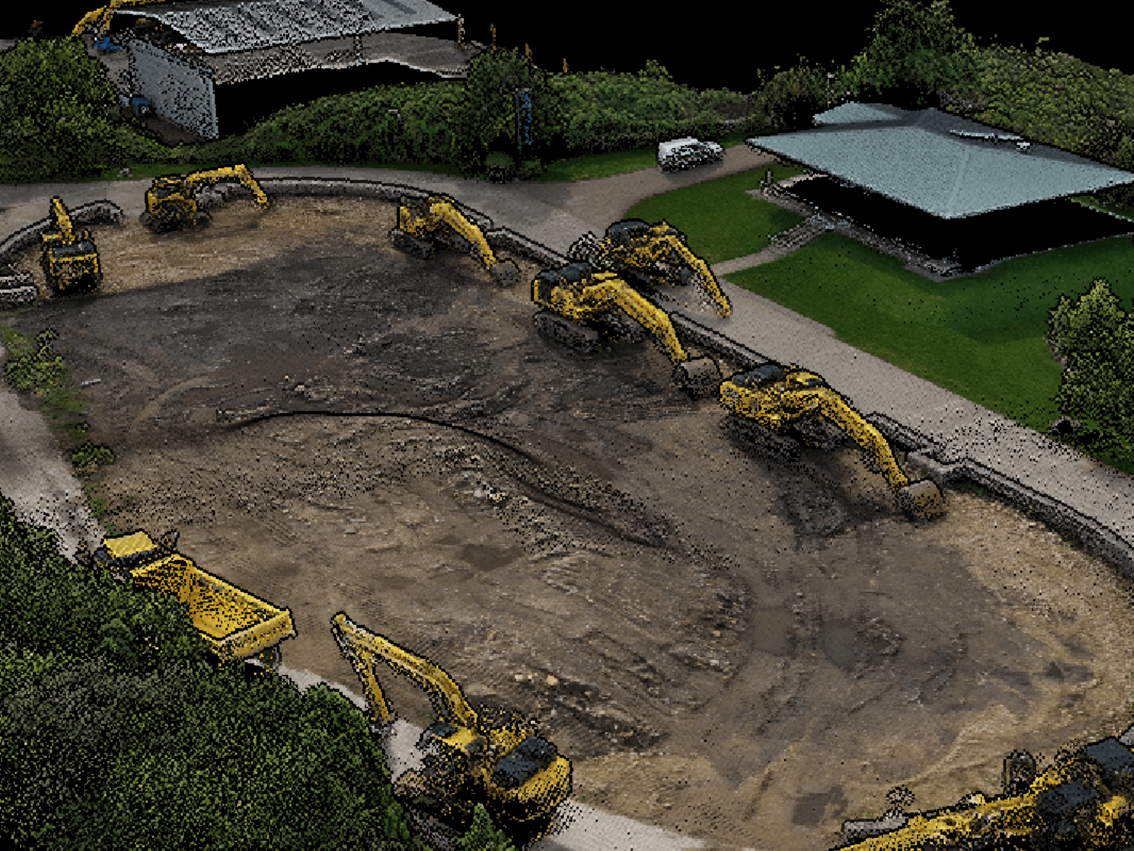
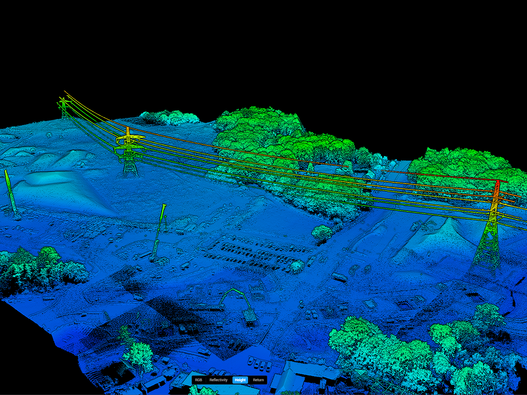
Digital Surface Models: Representations of the Earth's surface and objects on it. DSMs provide a comprehensive view of the terrain and surface features.
Digital Terrain Models: Represent the bare Earth surface without vegetation or man-made structures. Used in engineering, construction, and hydrology.
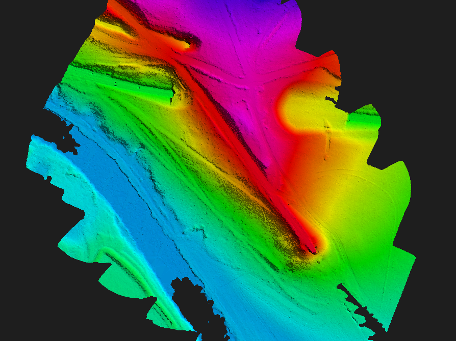
Contour Maps: Lines connecting points of equal elevation. Visualise terrain features and optimise project planning.
Cross-Sections: 2D representations of terrain or features along specific lines or transects. Analyse elevation changes, slope gradients, and other landscape characteristics.
Industry Applications
Topographic Mapping: Generate topographic maps with digital elevation models. Useful for land surveying, urban planning, engineering, and environmental management.
AEC/Surveying: Enhance planning, design, and management processes throughout the project lifecycle with as-built surveys, progress monitoring, and volumetric calculations.
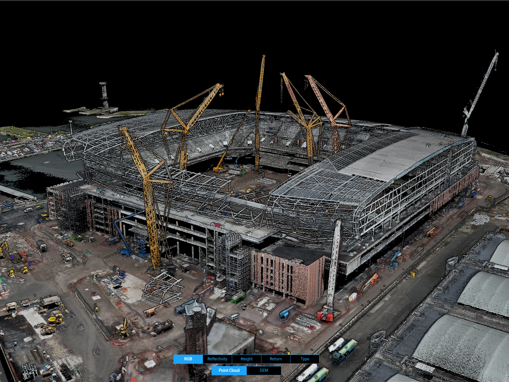
Public Safety: Deploy any time of the day for crime-scene reconstruction and vehicle collision analysis, or terrain mapping for search and rescue and disaster response.
Agriculture And Forestry Management: Observe vegetation density, height, and structure, analyse canopy width and growth trends, and estimate biomass and timber volume.
Archaeology: Detect subtle features on the landscape that could signify lost or hidden archaeological sites.
Mining: Accurate volume calculations, infrastructure analysis, face of stope monitoring, day-to-day stock management, and pre/post-mining surveys.
Energy And Infrastructure: Detailed asset monitoring, accurate vegetation management, and transmission line corridor planning for infrastructure resilience and optimised energy infrastructure operations.
Best LiDAR Drones And Sensors
DJI M350 RTK and DJI Zenmuse L2: The DJI M350 RTK is a flagship commercial drone with interchangeable payload capability, IP55 rating, and advanced safety features. The DJI Zenmuse L2 is a plug-and-play payload with LiDAR module and RGB camera. It offers 5 returns, a 450m detection range, centimetre-level precision, and true-colour point cloud generation.
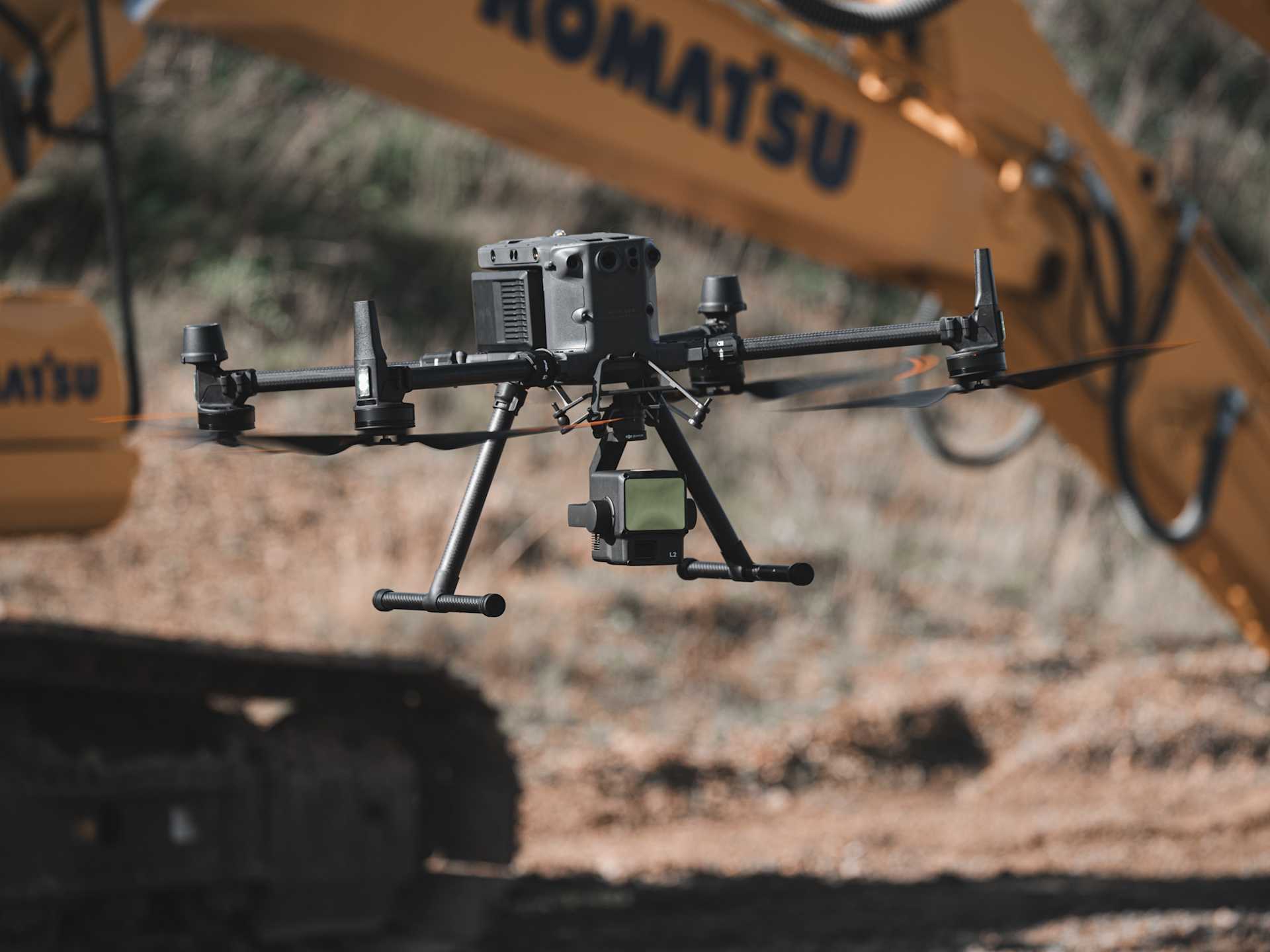
DJI M350 RTK and XGRIDS L2: The XGRIDS L2 is a handheld LiDAR scanner that can be mounted to the DJI M300 Series. The 32-channel option has a 300m scan range, while the 16-channel variant has a 120m range. Obtain precision data and true-colour point clouds.
Best Software For LiDAR Data Processing
DJI Terra: Perform accurate processing of LiDAR point cloud data captured by the DJI Zenmuse L2 and L1 with DJI Terra. Includes route calculation, precise fusion of point cloud and visible light data, ground point extraction, DEM generation, and mission report output.
Terrasolid: Terrasolid is an industry-leading software platform with a range of packages for drone LiDAR data. Includes an automated wizard for processing and can be used for cleaning, classifying, and analysing LiDAR data. Can be a companion software to DJI Terra.
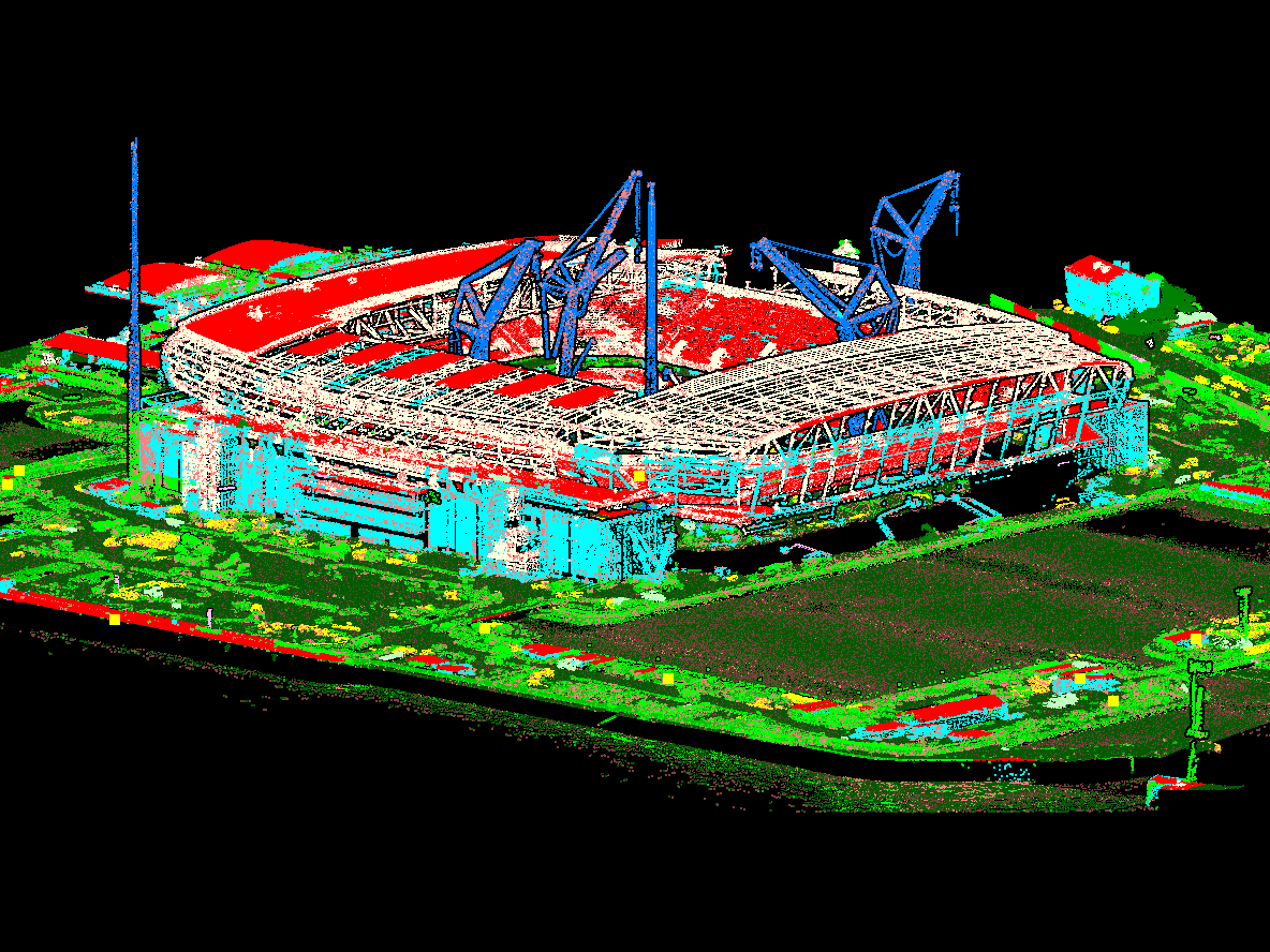
XGRIDS LixelStudio: Dedicated software studio for XGRIDS scanners. It provides viewing, editing, and one-stop processing services for laser point clouds and other data, along with industry plugins.
LiDAR vs Photogrammetry
LiDAR
Pro: Accurate elevation data, especially in densely vegetated areas, and good for small object detection.
Pro: Works effectively in low-light conditions.
Pro: Fast data-processing times.
Con: Typically limited photorealism and real-world colouring compared to photogrammetry. However, the DJI Zenmuse L2 has an RGB sensor to create more realistic and true-colour point clouds.
Con: Can be more costly than photogrammetry and can require greater expertise.
Photogrammetry
Pro: Excels in capturing rich visual details, textures, and colours, for enhanced visualisation.
Pro: Generally considered more user-friendly, and hardware is less expensive.
Con: Dense vegetation can obstruct the view of key features.
Con: Accuracy may vary depending on ground control and image quality.
Con: Longer data-processing times.
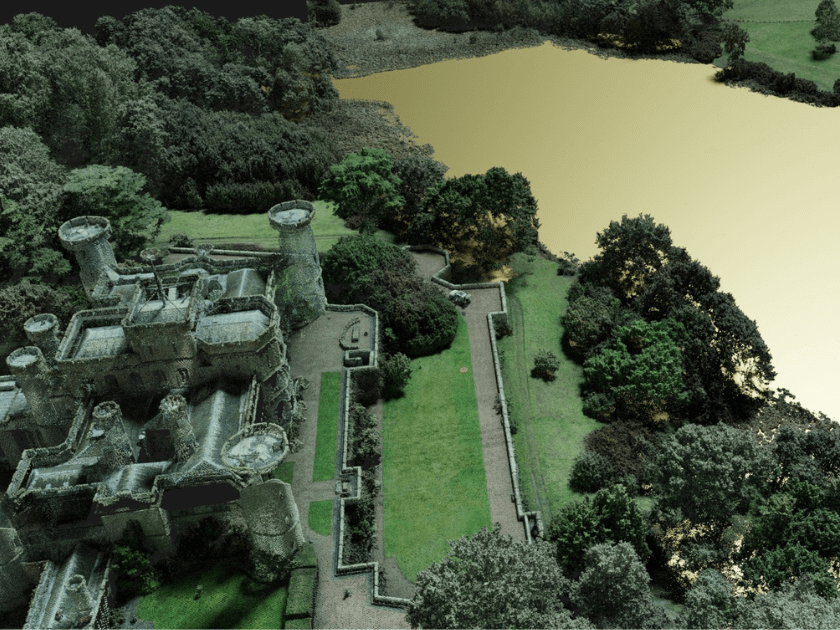
Drone LiDAR: Case Studies
1: Laing O'Rourke Deploy Drone LiDAR At Everton Stadium Development
Drone LiDAR was a key player during the development of Everton's new £550million stadium.
It was valuable for conducting accurate stockpile measurements, monitoring earthworks, and charting the infilling of Bramley-Moore Dock.
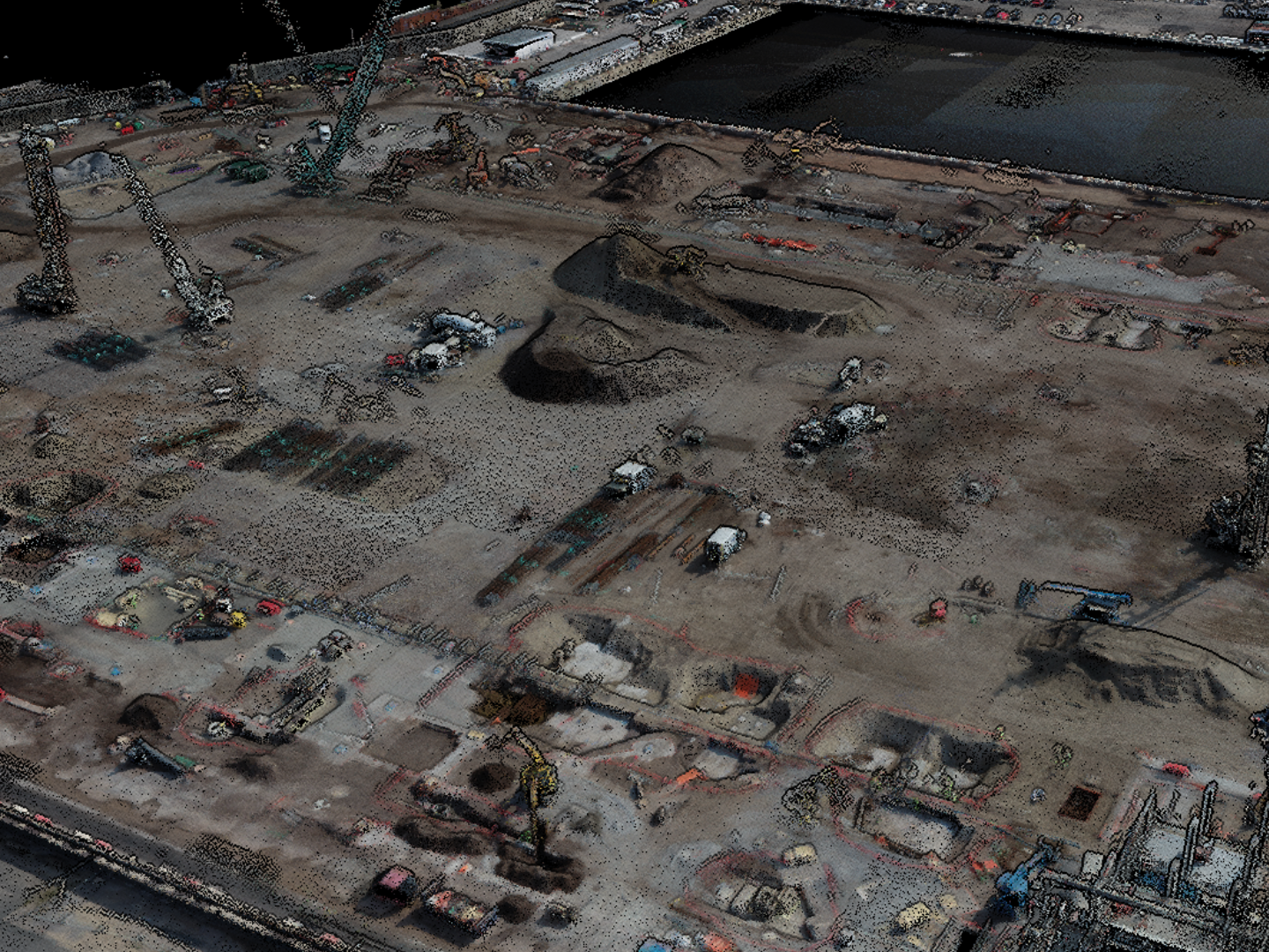
Deploying the DJI Zenmuse L2 on-site helped Select Plant Hire, subsidiary of main contractor, Laing O'Rourke, obtain increased accuracy and enhanced efficiencies.
2: Murphy Geospatial Benefits From L2 On HS2 Phase One Build
Murphy Geospatial deployed the DJI Zenmuse L2 during the construction of a viaduct, as part of the HS2 development.
The company used the L2 for:
Accurate ground-level information, particularly in areas of high-density vegetation.
Building/urban environments where very fine/small features needed recording.
Quantity surveying, especially where the material or ground has high reflective properties/characteristics.
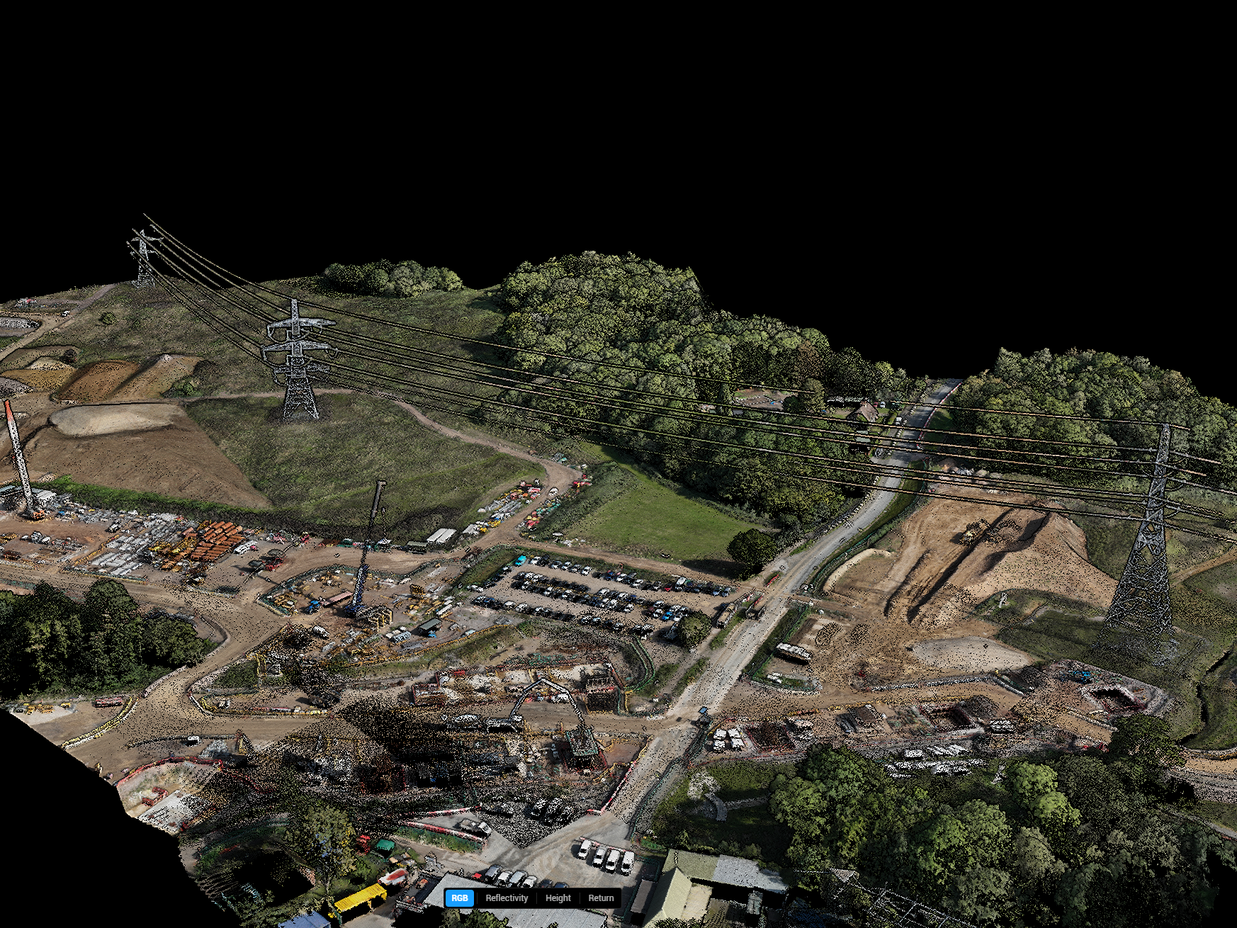
Pedro de Gouveia, Chief UAV Pilot at Murphy Geospatial, said: "As we have seen with the L2 data, the extra detail in finer features such as powerlines and more robust vegetation penetration yields better quality results."
3: Drone LiDAR Enhances Event Planning
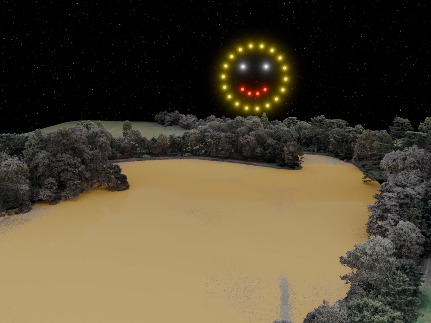
MLE Pyrotechnics uses the DJI Zenmuse L2 to enhance its planning of drone light shows and firework displays.
The company uses drone LiDAR for:
The creation of 3D site models, integrated with firework display or drone show simulations, for immersive, true-to-life client previews.
Accurate object measurement, including trees and buildings.
Checking audience view-points and lines of sight.
General site planning, such as site access and entry. Drone data provides up-to-date information for enhanced planning.
How heliguy™ Supports Your Drone Surveys
In-house geospatial specialists offering consultancy, proof of concept, equipment supply, and drone survey training.
Drone Assistive Programme: Our specialists can attend your site to help you collect real-world data to help you learn on the job.
Obtain your permissions to fly your drone with the support of our 10-strong training team.
Access the UK's largest drone rental fleet to access equipment on-demand, only when you need it.
Leverage support from our in-house DJI-approved repair centre, should something go wrong with your equipment or you crash your drone.