Technical
Published on 20 Dec 2024
James Willoughby
How we used our GIS (survey) team in our BVLOS application
How precise drone mapping data can revolutionise BVLOS drone-in-a-box operations.
Drone survey data can play a crucial role in BVLOS OSC applications;
Precise geospatial data provides an accurate and up-to-date picture of an application site to assess ground and air risk;
heliguy™ submitted a catalogue of 3D models and LiDAR point clouds to the UK CAA, as part of its approval for BVLOS drone-in-a-box operations;
heliguy™ will work with drone programmes to help them unlock remote and automated BVLOS missions in atypical air environments (AAE) with the DJI Dock ecosystem.
When it comes to advancing drone operations, nothing is as transformative as combining cutting-edge technology with precise geospatial data.
This blend has been the key to heliguy™'s revolutionary approval for Beyond Visual Line of Sight (BVLOS) drone-in-a-box operations in the UK. You can find out more about it here.
Let’s explore how drone mapping and survey data are unlocking new horizons for enterprise drone programmes.
Pioneering Drone-In-A-Box BVLOS Operations
heliguy™’s BVLOS approval is a landmark in the realm of autonomous drones.
It empowers the team to support enterprises in deploying remote and automated BVLOS missions in atypical air environments (AAEs).
Operations conducted within an AAE are made under conditions that enable a drone to fly in areas of airspace that are never/or only very occasionally used by other aviation users.
The BVLOS missions conducted by heliguy™ will be powered by the DJI Dock ecosystem, which seamlessly integrates drones and automation.
Our in-house regulatory and GIS teams are at the forefront of this innovation, applying advanced geospatial techniques to ensure operational safety.
These methods will be pivotal as we assist clients in building site-specific BVLOS applications.
Why Drone Survey Data is Indispensable
Drone mapping delivers a real-time, accurate snapshot of any operational site, vital for assessing both ground and air risks.
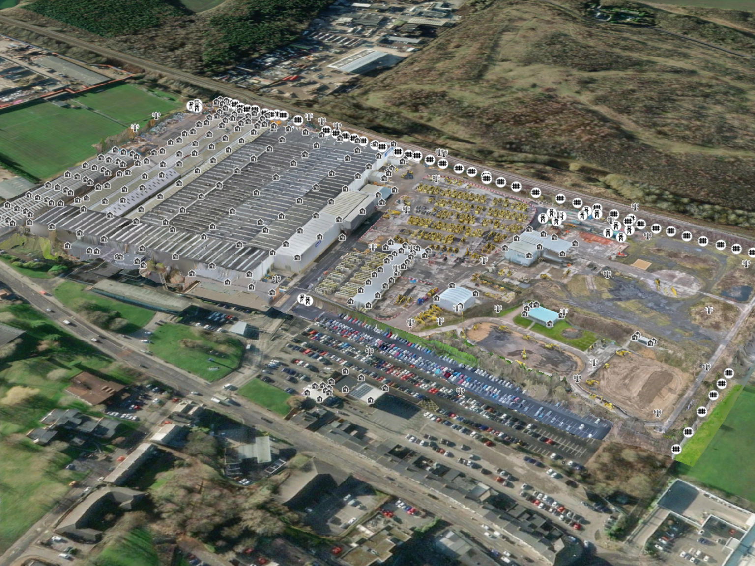
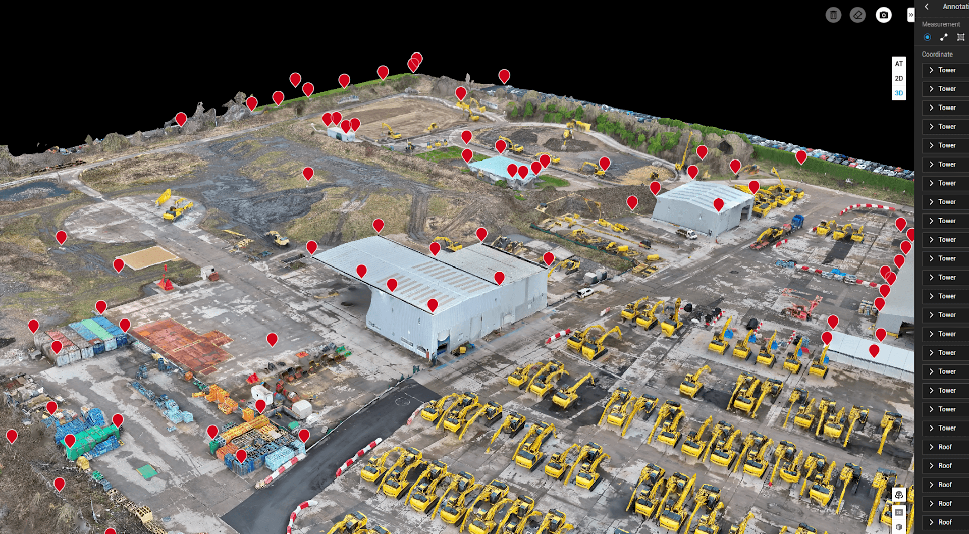
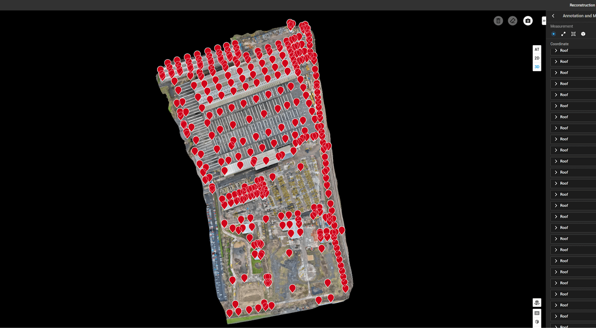
For heliguy™’s OSC application, based on BVLOS flights at Komatsu’s Smart Construction site in the North of England, the team leveraged a suite of 3D models and LiDAR point clouds.
These datasets, submitted to the UK Civil Aviation Authority (CAA), were instrumental in:
Proving compliance with airspace safety criteria;
Demonstrating the feasibility of BVLOS operations in AAEs;
Mapping obstacles and creating omnidirectional buffer zones for drone safety;
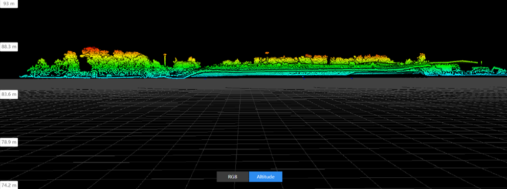
Showing site-specific features, such as elevation profiles and obstacle heights.
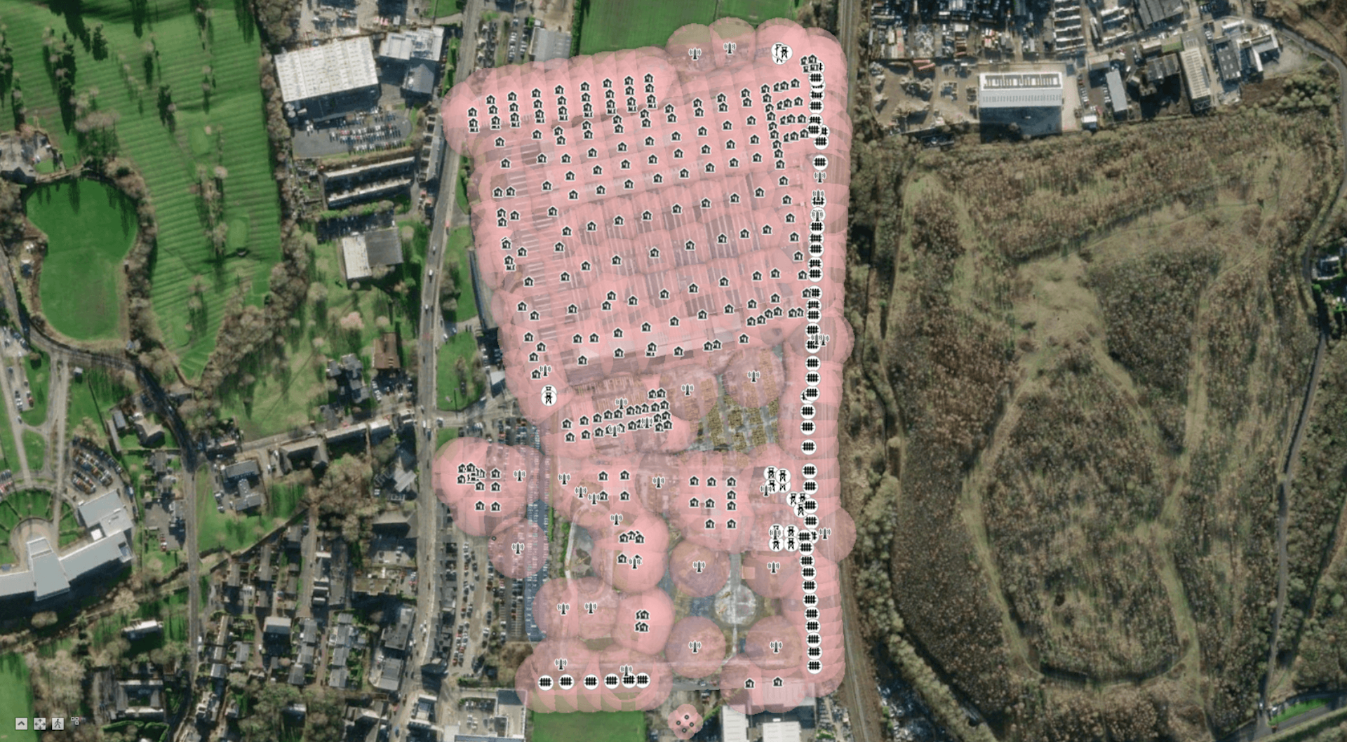
DJI Terra was used for the majority of the processing, while Esri's ArcGIS Pro - which Heliguy is using as part of a proof of concept process - was utilised to add the clearance buffers.
Expert Insights: Integrating Data for Safety and Compliance
Technical Geospatial Specialist Alex Williams, who spearheaded the processing of the drone data for the OSC application, highlighted its role in ensuring operational safety.
He said: “This data provided a compelling case for safe BVLOS operations, addressing obstacle clearance, radio line-of-sight considerations, and compliance with AAE criteria.”
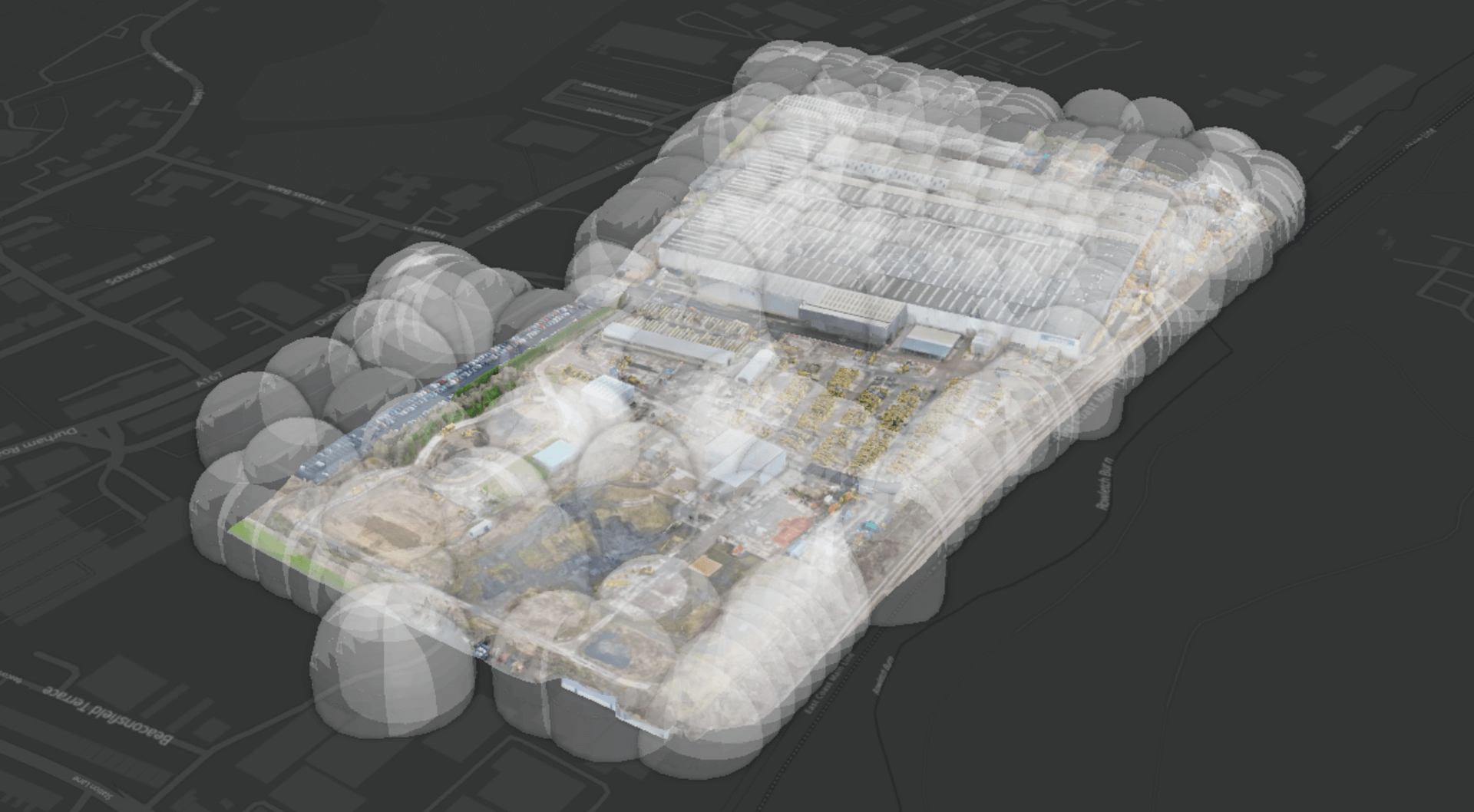
Harnessing DJI Ecosystem For BVLOS Site Mapping
The site survey was conducted using the DJI Dock 2 paired with a Matrice 3D drone, equipped with a precision 20MP 4/3 sensor and mechanical shutter for precision survey tasks.
Upon the drone's return to the dock, the collected data was automatically uploaded to DJI FlightHub 2 through the cloud mapping functionality. It was later imported into DJI Terra.
The LiDAR point clouds were created through a separate mission with the DJI Zenmuse L2 LiDAR sensor and DJI M350 RTK drone, and the point clouds processed through DJI Terra.
Unlocking BVLOS for Enterprise Clients
heliguy™’s BVLOS approval paves the way for new possibilities. By partnering with enterprises, we aim to simplify the adoption of BVLOS operations through a comprehensive support package.
Highlights include:
Remote Operations: heliguy™ pilots can operate remotely from heliguy™’s Remote Operations Control Centre (ROCC) at heliguy™ HQ, or from the heliguy™ Drone Command Unit - a fully-equipped mobile control room.
Customised Solutions: Each site undergoes a rigorous approval and mapping process.
Continuous Monitoring: Ongoing data collection ensures compliance and operational excellence.
Join the Future of Drone Operations
heliguy™ is here to make BVLOS a reality for enterprise drone programmes. From initial mapping to seamless execution, our expertise guarantees safety, compliance, and efficiency.
Ready to elevate your operations? Get in touch with us today. Let’s redefine what’s possible with drones.
