Case Studies
Published on 15 Mar 2024
James Willoughby
Woodland Trust Deploys Drones To Revolutionise Deer Surveys
The Woodland Trust is using DJI drones for deer surveys, enabling the Trust to collect data more accurately and efficiently.
Woodland Trust deploying drones for deer surveys;
Drone data enables accurate population counting, with minimal disturbance and locating deer across a range of habitats;
The Trust uses the heliguy™ drone rental fleet, accessing drones on-demand for the census, which is conducted once a year;
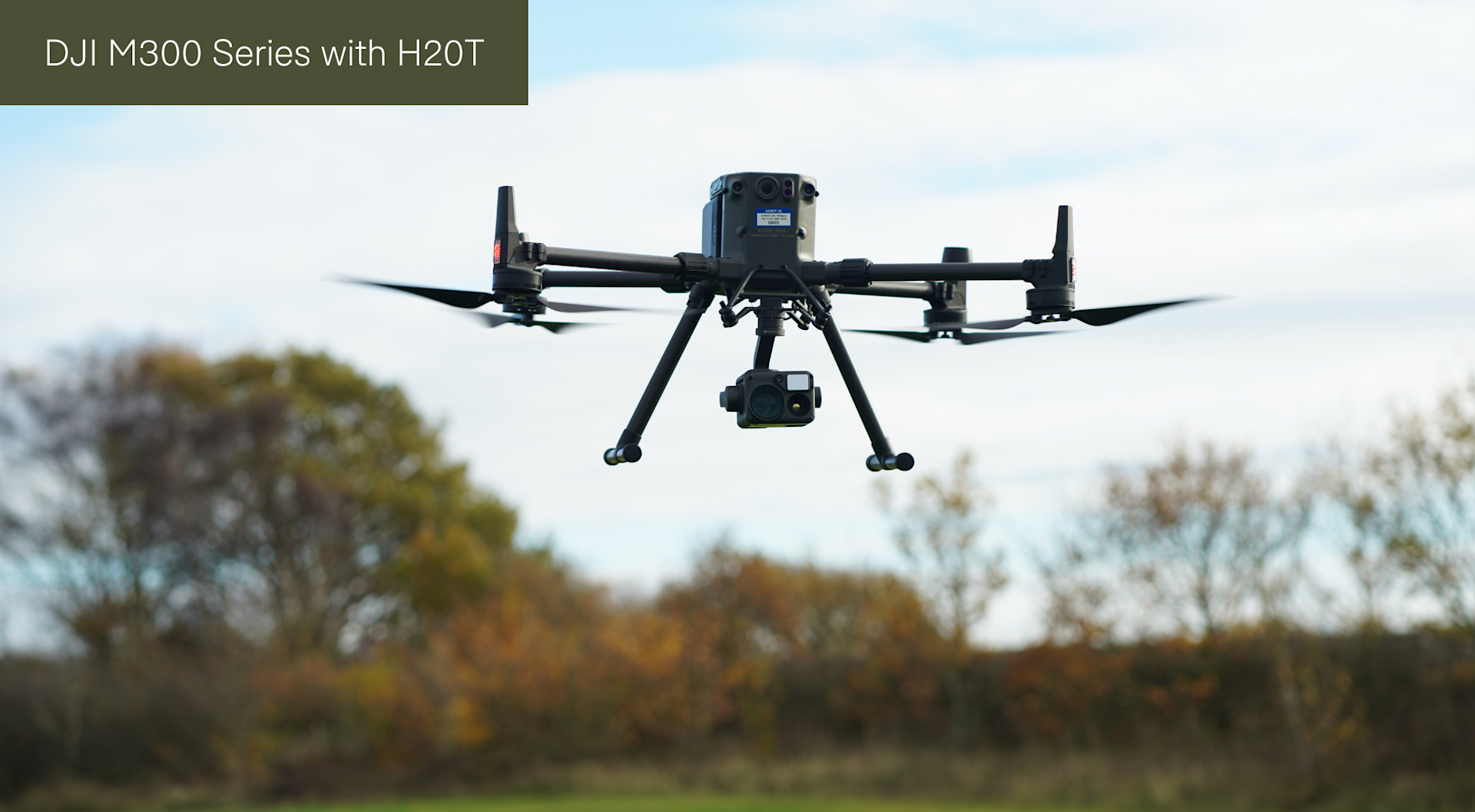
DJI M300 RTK drone series and H20T payload used for the census: Thermal sensor finds the deer, and RGB camera assesses the animals.
Drones have revolutionised deer surveys conducted by the Woodland Trust - collecting data more accurately and efficiently and providing new insights on population metrics.
The Woodland Trust has been trialling this method and a census has been conducted once a year. Using the heliguy™ drone rental fleet to access the latest technology on-demand, and only when required - the conservation charity has removed the burden of being left with redundant equipment.
The Woodland Trust's team in Devon has deployed the DJI M300 Series drone and H20T payload for the annual count: Using the thermal camera to locate deer and then the high-resolution RGB camera and zoom to assess the population.

Live insights are recorded on Esri ArcGIS Field Maps - an all-in-one mobile app for field data collection, map viewing and real-time location sharing. Drone technology provides the following benefits:
Efficiency: Drones cover more ground than conducting a survey on foot. The team can cover approximately 200 hectares (500 acres) in a day with a drone.
Minimal Disturbance: Vital insights about species, sex, and age can be gathered from more than 100m away - increasing survey speed and enabling data collection without disturbing the animals.
Accessibility: Drones can access hard-to-reach areas and locate deer across a range of habitats - particularly woodland - where other census methods might have struggled.
Accurate Counting: Drones offer a landscape view, offering a more comprehensive and complete picture of species distribution and density. This builds confidence that deer are not being undercounted or double-counted.
David Rickwood, Woodland Trust Site Manager for Devon, said: "Drone technology helps to grow our understanding of deer population metrics with an unprecedented level of accuracy and efficiency.
"Deploying the drone enables us to cover more ground, more quickly, and means we can view the population - determining sex, age, and health - with a lot less disturbance.
"Having such a detailed understanding of population dynamics allows us to understand what is recruited into that population on an annual basis and helps to develop a suitable and robust management plan."
Revolutionising Deer Surveys With Drones
Traditionally, a survey would have started by walking the fields and woods in the areas where deer are likely to be present, looking for hoof prints, droppings and overnight ‘scrapes’.
Other signs, such as hairs caught on barbed wire or the seasonal bark stripping or ‘fraying’ of trees, also helped to fill in pieces of the picture, but it would be difficult to put a number on the local population from these clues alone.
Now, drones are providing an alternative solution - helping to efficiently monitor deer populations in great detail.
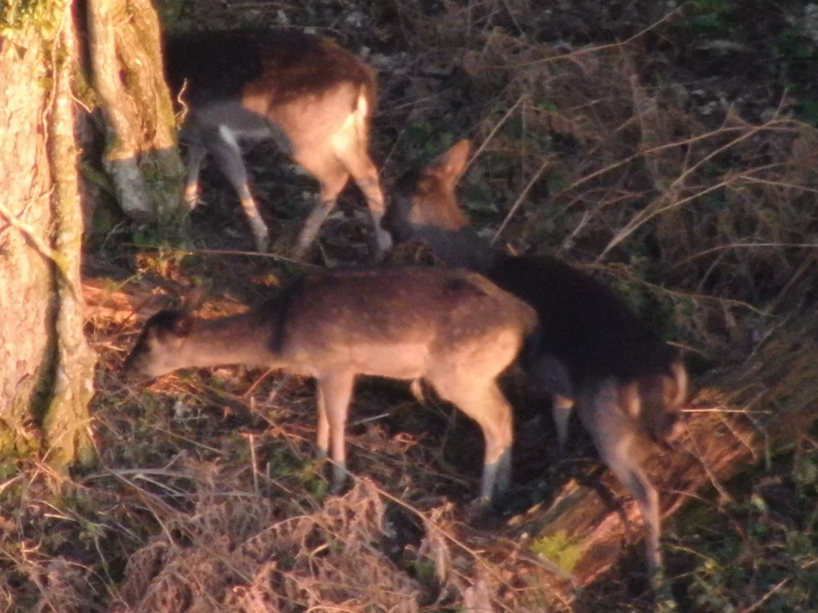
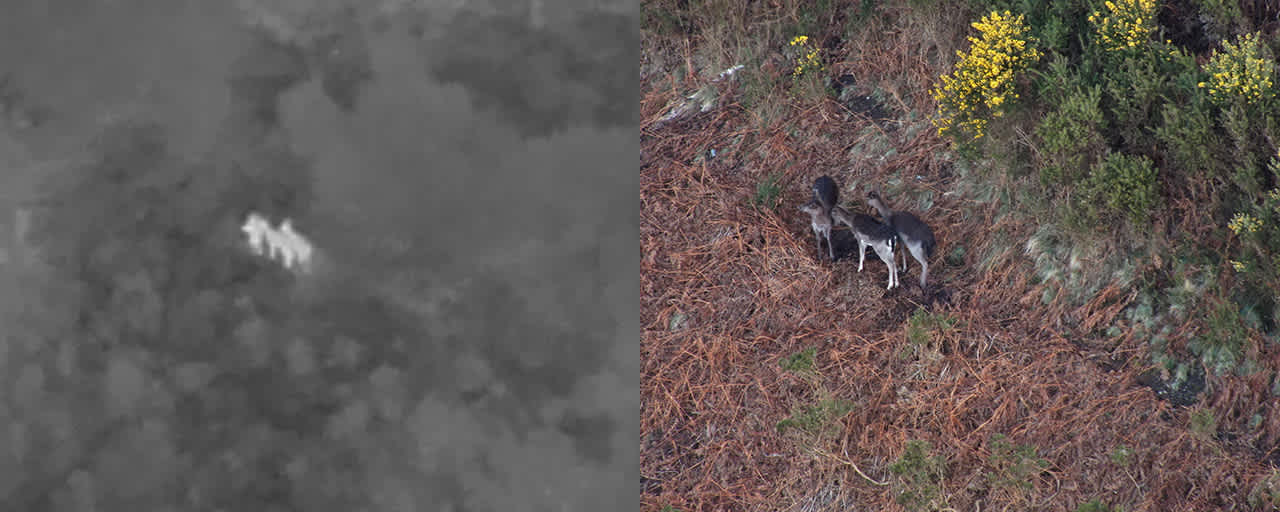
For instance, this series of images - collected from more than 100m away during surveys conducted along the Teign Valley, and other woodland valley sites around Dartmoor - provide rich insights about the deer.
The animal in the middle of this small group of fallow deer is identified as a buck fawn.

Meanwhile, the level of detail collected from the drone imagery enables the team to identify the deer below as roe doe, thanks to distinguishing features such as the visible anal tush, caudal patch, absence of a tail, the black muzzle, and black-rimmed ears.

David said: "The drone images provide sufficient detail to record herd structure, including insights on species, sex, and age of deer.
"The drone doesn’t need to be very close to the deer to be able to see them as the zoom on the camera is very powerful, so the majority of the time we are able to observe them without any disturbance.
"This enables us to view the animals in their natural behaviour and environment, which is a significant benefit compared to conducting a survey on foot, because even someone who is walking carefully through an area can disturb the deer and cause them to move - which impacts the accuracy of the count.
"The drone also allows us to reach more areas, easily. For instance, in Devon, our team can encounter steep hills, gorse, and bracken, so the drone increases accessibility in these locations."

Drone imagery offers a visual way of presenting the data to better inform the management of the species on the ground, and provides a comprehensive picture of deer population metrics throughout the landscape.
David said: "The power of the drone is that it enables our surveys to be conducted on a landscape scale, providing a larger overall view of the population, rather than collecting information from a localised viewpoint.
"This provides more accurate insights to determine if there is a population imbalance and use this data to better inform deer managers and landowners.
"And crucially, this data can be turned around very quickly after the survey and presented to the relevant stakeholders in a timely fashion."
Deer Survey Workflow
The drone data is collected as quickly as possible in a methodical way, with planning and moving between flight points being crucial for an accurate census - avoiding double-counting or having deer move in or out the survey area. Considerations include:
Contact with site owners to discuss permissions and areas for the survey can improve the flight planning and can include site visits if the area is unfamiliar.
Knowledge of local landowners, managers or deerstalkers is helpful and their experience of the site and recent deer movements is useful before and during the survey.
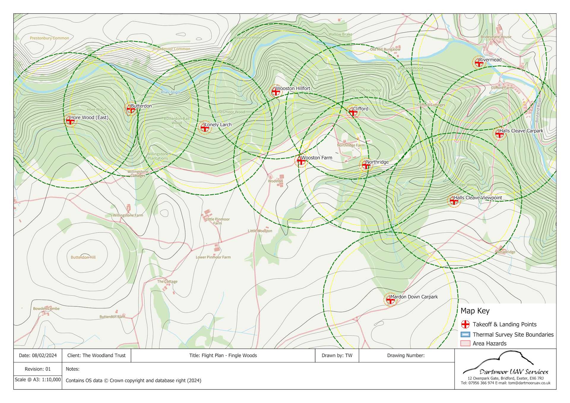
Desktop surveys are required to map the launch sites and flight zones. ArcGIS, QGIS, or similar software is useful to produce maps and flight plans.
Health and safety assessments completed by the qualified drone pilot.
Access plan will consider local roads, forest tracks and footpaths to find the most suitable launch locations and flight zones.
The map below demonstrates a typical flight plan for a large estate, showing the site boundary, flight zones with take-off and landing points, and hazards.

"Optimum planning is done in cooperation with all parties so they will all benefit from the exercise, and shared knowledge and results of the survey," said David. The survey itself will follow a thorough step-by-step procedure, including:
Upon arrival, check the landscape for hazards, including pylons, powerlines,overhanging trees, roads, paths, buildings, and other potential conflicts with people and livestock.
During flight, the drone will be kept within visual line of sight at all times.
Scan flight zone with thermal imaging camera to pick up heat signals worth further/closer inspection. The H20T has a 640 x 512 px radiometric thermal sensor with 8x digital zoom.
Pinpoint hotspot (possible deer) with thermal camera.
Zoom with optical camera for detailed identification, such as species, age, and sex. The 20MP zoom camera on the H20T is capable of 23x hybrid optical zoom and 200x maximum zoom.
Deploy laser rangefinder on the H20T to pin the location and set an individual sighting number.
Sighting number is logged on the ArcGIS Field Maps app on a hand-held tablet and full details of deer are recorded, relating to each pin location.
Recording the individual deer at each location requires the skill and experience of an on-site deer surveyor or stalker, using a relay flight control unit.
Drone Hire Benefiting Deer Surveys
The deer surveys are conducted once a year: Typically in the winter, because the lack of foliage in the woodland canopy provides a better view of the movements of deer at ground level. As such, the Trust chooses to hire equipment from heliguy™ - home to the UK's largest drone rental fleet - rather than purchase it outright.

David said: "Drone rental is a more user-friendly option for us. It is really helpful to be able to hire the equipment, because it means we only need to have it on a temporary basis, when we need it.
"Technology also updates very quickly, so renting provides us access to the latest equipment, rather than being left with surplus or ageing kit.
"Renting also reduces the maintenance work for us: The equipment turns up ready to fly without the need for us to update the firmware or maintain it, because this is all managed by heliguy™ who do it for you."
Future Of Drones For Woodland Trust
Through the deer surveys, the Woodland Trust has proved the concept of drones.
And looking ahead, David believes the technology can be deployed to benefit a wider range of use cases.
He said: "Moving forward, I can see the Woodland Trust using drones for multiple purposes.
"LiDAR is a great example and is valuable for our work on water courses, drainage lines, and natural flood management.
"These areas require insights about the landscape, contours, surface runoff and flow dynamics, and drone LiDAR will be particularly useful for this."

